UAE map
Facts and Figures

Official Name United Arab Emirates
Population 2,563,200
Population & Density (all countries) here
Capital City Abu Dhabi (528,000)
Currency Emirati Dirham (AED)
Currency Converter here
Languages Arabic (official), English, others
National Day December 2 Religions Muslim (96%), others
Geographic Coordinates
Latitude/Longitude (Capital City)
24آ؛ 27' N, 54آ؛ 23' E

Relative Location The United Arab Emirates is in both the northern and eastern hemispheres. It's positioned in the Middle East, a recognized geographical region of southwestern Asia. It's bordered by the Persian Gulf, and the countries of Oman and Saudi Arabia.
Land Statistics
Coastline 819 miles (1,318 km)
Land Areas
(land) 32,000 sq miles (82,880 sq km)
 (water) 0 sq miles (0 sq km)
 (TOTAL) 32,000 sq miles (82,880 sq km)
Landforms Most of the United Arab Emirates is a desert wasteland, with large, rolling sand dunes, as the outer reaches of the Rub' Al Khali Desert stretch into the country.
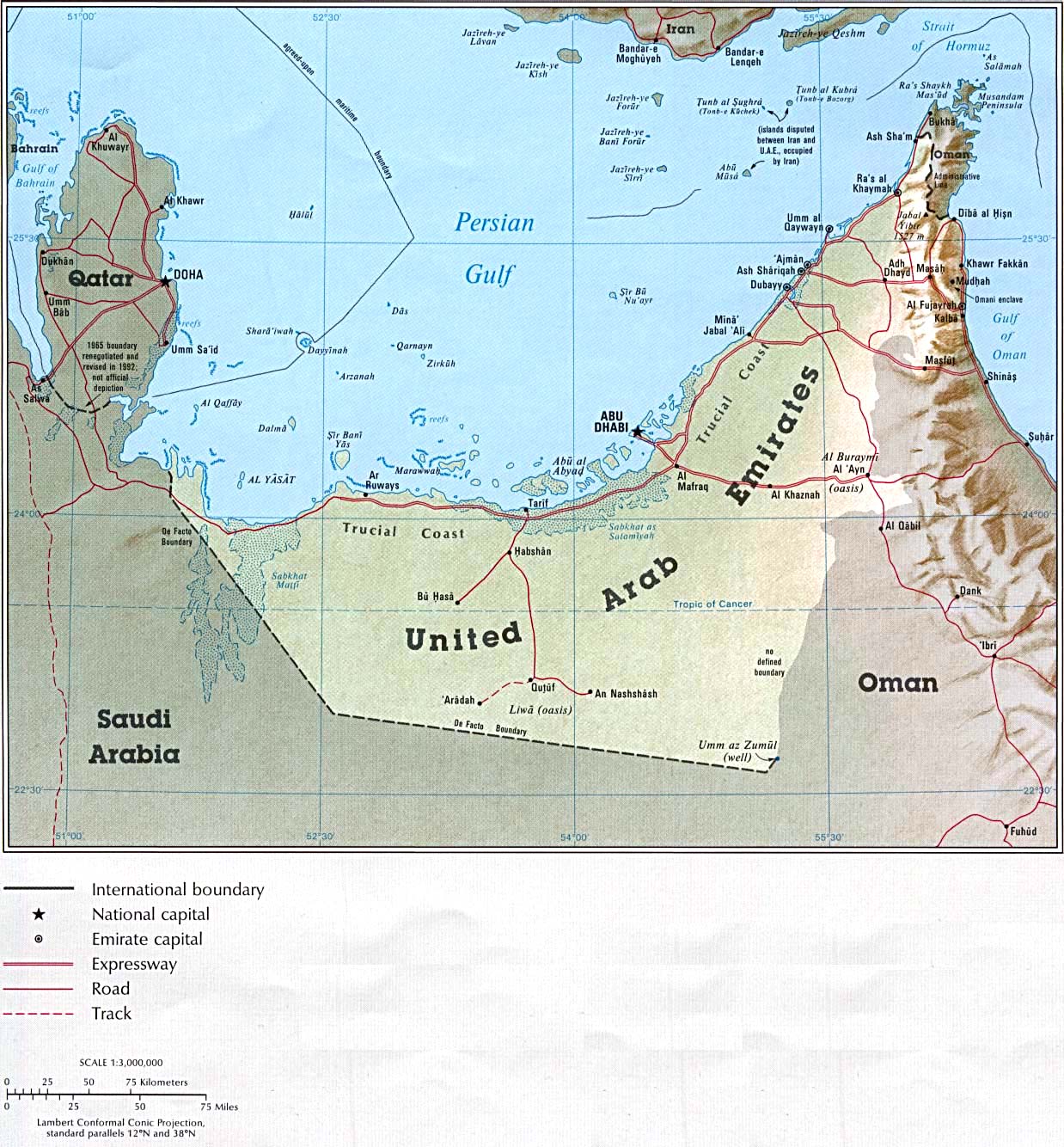
The coastal areas fronting the Persian Gulf are flat. The Hajar Mountains dominate the landscape in the northeast, and the country's highest point is located there, and there are no significant rivers or lakes of note.
Numerous small island and inlets are situated offshore in the Persian Gulf.
Highest Point Jabal Yibir - 5,666 ft. (1,727 m)
Lowest Point Persian Gulf - 0 ft. (0 m)

Land Divisions 7 emirates, including: Abu Zaby (Abu Dhabi), 'Ajman, Al Fujayrah, Ash Shariqah (Sharjah), Dubayy (Dubai), Ra's al Khaymah and Umm al Qaywayn.
0 comments:
Post a Comment